Maps & Navigation with GPS for city, traffic,transport: Satellite & Street View.
advertisement
| Name | 🇬🇧Maps & GPS Navigation: Find your route easily! |
|---|---|
| Version | 8.0.2 |
| Update | Dec 12, 2018 |
| Size | 7 MB |
| Category | Maps & Navigation |
| Installs | 10M+ |
| Developer | We love maps |
| Android OS | Android 4.0+ |
| Google Play ID | com.magnetic.openmaps |
🇬🇧Maps & GPS Navigation: Find your route easily! · Screenshots


🇬🇧Maps & GPS Navigation: Find your route easily! · Description
Travel around the globe or look around the world with a swipe of your finger and get live Maps, GPS Navigation and Directions! Find your current location or search for an address and navigate using googlemaps or OpenStreetMap (OSM) to your destination.
Maps, GPS Navigation and Directions is an app that allows you to travel at ease knowing that you will always have GPS coordinates as you hike, bike, drive or bus it! Doesn’t matter what transportation you use as our app includes City, Satellite, Traffic, Public Transit, Cycling and even a map for Hiking. Navigate with ease and always find your location with our app!
Map Layers for more info on location include:
• Wikipedia - For more info
• Youtube - Watch videos of location
• Photos from Panoramio & Street view
• Weather - Access local weather & weather maps
WORLD MAP
Travel around the world and navigate using any method of transportation:
• Route Planner - route your car or bike to any global address, from Barcelona to Tokyo
• Driving directions with local traffic help you find the fastest trip route
• Navigator offers step-by-step travel directions around the world
• Trip planner lets you find a bus schedule, nearby hotels, stores near me, & more
MAP TYPES - Maps come in types, from satellite maps to bike maps and street view.
• City map with more details than Google maps – you will navigate the city with ease!
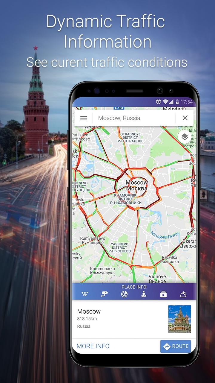
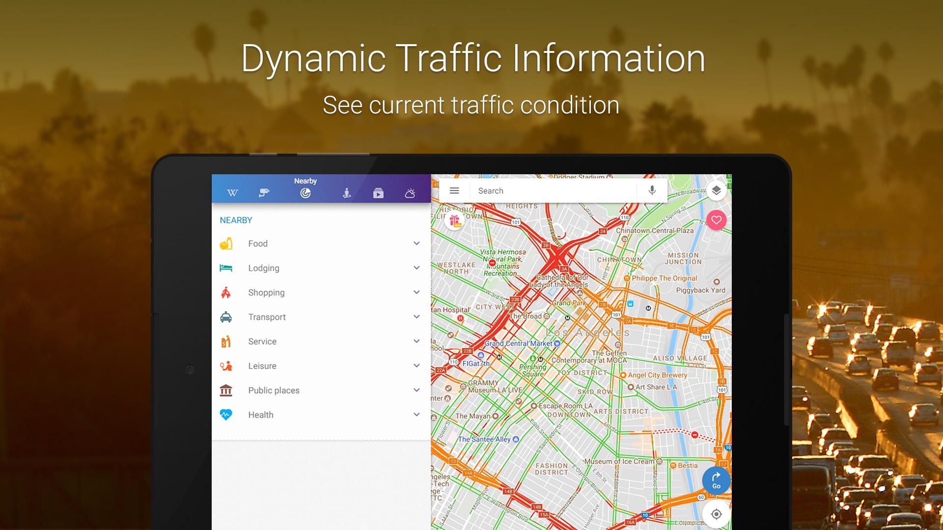
• Traffic map : See current traffic conditions to avoid traffic jams
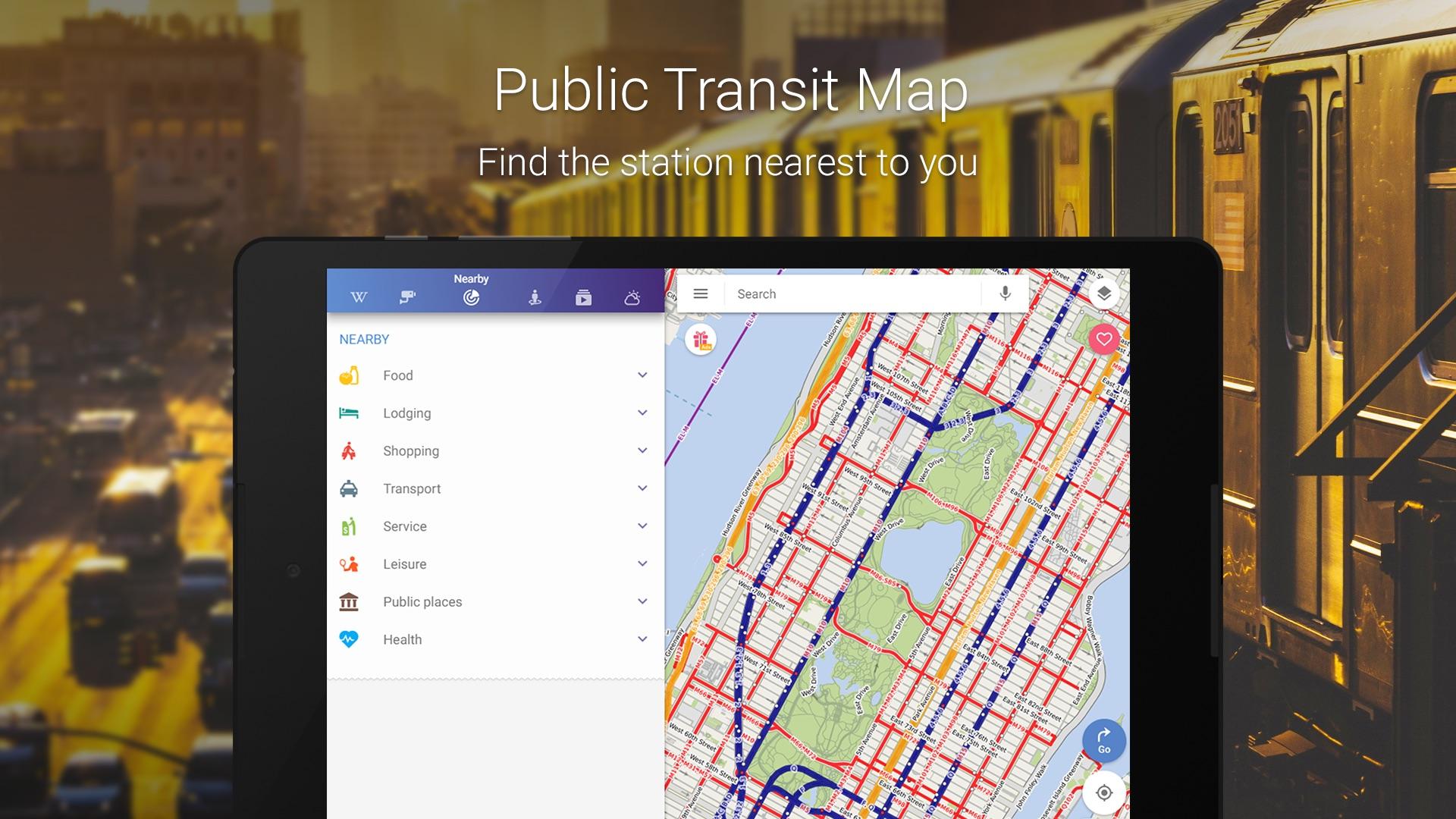
• Public transport map with train schedule, bus and subway routes - find the station nearest to you to get around town like a local
• Cycling map with bike routes - plan your next cycling tour
• Walking map – Explore with walk-friendly maps - discover the city in the best way possible: on foot.
• Trails map - Navigate your next hike with a hiking map
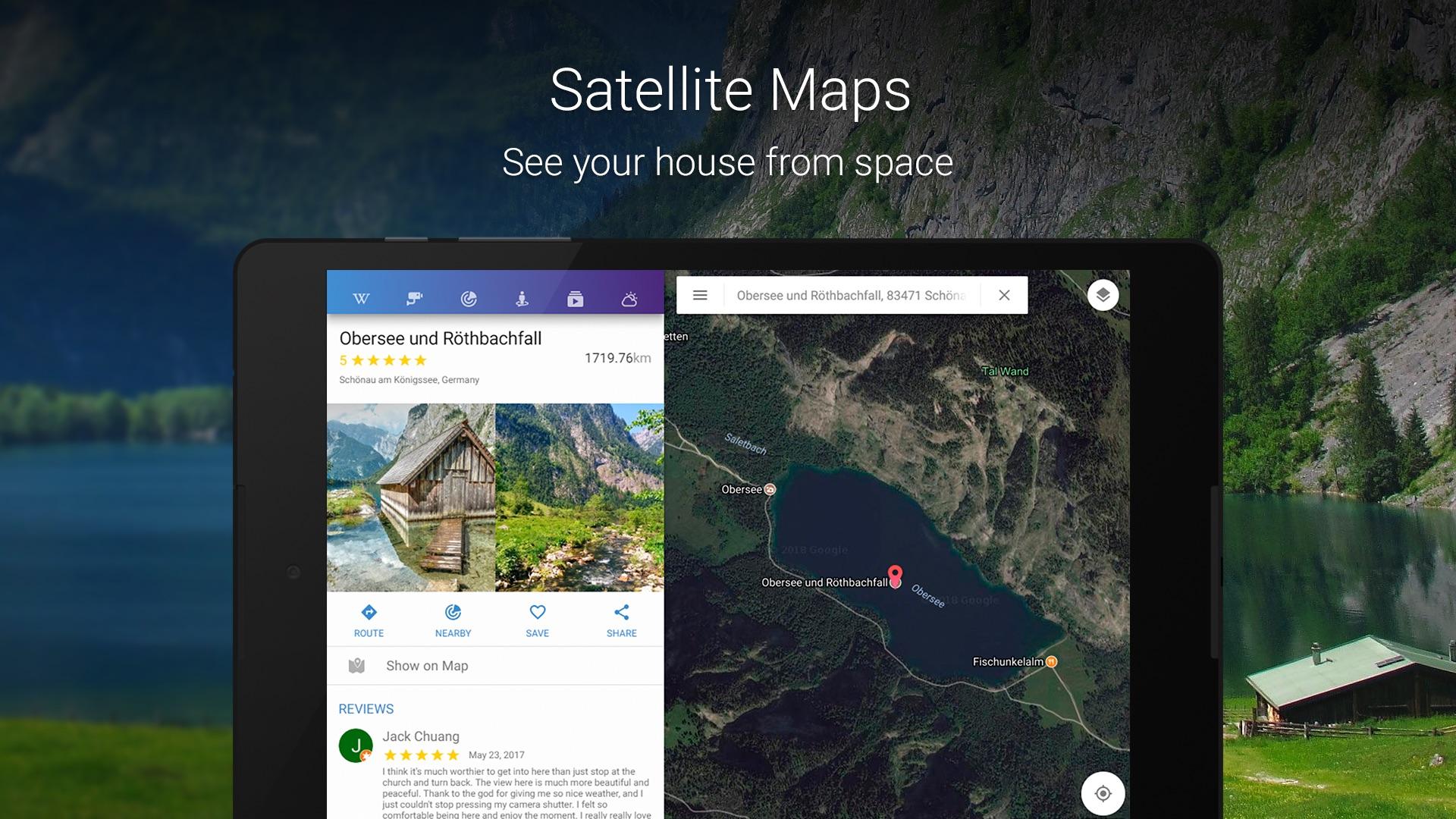
• Satellite view from googlemaps – enjoy the view from the space
• Traffic conditions and transit maps included
MAP FEATURES
Layers of maps provide fascinating data:
★ Photos on map: Photos from worldwide photo sharing database Panoramio and Street view
★ Videos on map : Localized videos on YouTube
★ Wiki on map: Wikipedia guide - read Wikipedia information about selected cities, sights, attractions and interesting places
★ Street view on map: Get a street level view of the world and terrain with street view
★ Live Webcam Video on map: Webcam video from around the world displayed on maps
GPS Location & Tracker
Find local addresses and search terms easily with the Autocomplete function. It uses your location to propose results in the area. Autocomplete function works with:
• Addresses (street name & house number, city) : Location based address search
• ZIP code : Nearby city and neighborhood zip codes
• Places Around Me : Find hotels, restaurants, shopping, museums, stations, hospitals and more ‘near me’
• GPS Coordinates - Recognition of your location via GPS (latitude, longitude)
• IP address Tracker when available.
• Maps, Navigation & Directions uses googlemaps and OpenStreetMap (OSM).
Explore your city
• Worldwide, street, satellite, traffic, public transit, cycling, walking and hiking even weather maps.
• Webcam - You can watch thousands of live webcams to see what is the weather or the traffic in the city! If you live in the UK e.g. London or Birmingham, Liverpool or Bristol and others.
OpenStreetMap (OSM) is a collaborative project to create a free editable map of the world. Two major driving forces behind the establishment and growth of OSM have been restrictions on use or availability of map information across much of the world and the advent of inexpensive portable satellite navigation devices. For more information seen www.openstreetmap.org
UK Maps:
• London
• Birmingham
• Leeds
• Glasgow
• Sheffield
• Bradford
• Liverpool
• Edinburgh
• Manchester
World Countries & Cities:
• New York
• Paris
• Barcelona
• Amsterdam
• Beijing
• Tokyo
• Toronto
• San Francisco
• Munich
• Sydney
• More
Download Maps, Navigation & Directions today!
Maps, GPS Navigation and Directions is an app that allows you to travel at ease knowing that you will always have GPS coordinates as you hike, bike, drive or bus it! Doesn’t matter what transportation you use as our app includes City, Satellite, Traffic, Public Transit, Cycling and even a map for Hiking. Navigate with ease and always find your location with our app!
Map Layers for more info on location include:
• Wikipedia - For more info
• Youtube - Watch videos of location
• Photos from Panoramio & Street view
• Weather - Access local weather & weather maps
WORLD MAP
Travel around the world and navigate using any method of transportation:
• Route Planner - route your car or bike to any global address, from Barcelona to Tokyo
• Driving directions with local traffic help you find the fastest trip route
• Navigator offers step-by-step travel directions around the world
• Trip planner lets you find a bus schedule, nearby hotels, stores near me, & more
MAP TYPES - Maps come in types, from satellite maps to bike maps and street view.
• City map with more details than Google maps – you will navigate the city with ease!
• Traffic map : See current traffic conditions to avoid traffic jams
• Public transport map with train schedule, bus and subway routes - find the station nearest to you to get around town like a local
• Cycling map with bike routes - plan your next cycling tour
• Walking map – Explore with walk-friendly maps - discover the city in the best way possible: on foot.
• Trails map - Navigate your next hike with a hiking map
• Satellite view from googlemaps – enjoy the view from the space
• Traffic conditions and transit maps included
MAP FEATURES
Layers of maps provide fascinating data:
★ Photos on map: Photos from worldwide photo sharing database Panoramio and Street view
★ Videos on map : Localized videos on YouTube
★ Wiki on map: Wikipedia guide - read Wikipedia information about selected cities, sights, attractions and interesting places
★ Street view on map: Get a street level view of the world and terrain with street view
★ Live Webcam Video on map: Webcam video from around the world displayed on maps
GPS Location & Tracker
Find local addresses and search terms easily with the Autocomplete function. It uses your location to propose results in the area. Autocomplete function works with:
• Addresses (street name & house number, city) : Location based address search
• ZIP code : Nearby city and neighborhood zip codes
• Places Around Me : Find hotels, restaurants, shopping, museums, stations, hospitals and more ‘near me’
• GPS Coordinates - Recognition of your location via GPS (latitude, longitude)
• IP address Tracker when available.
• Maps, Navigation & Directions uses googlemaps and OpenStreetMap (OSM).
Explore your city
• Worldwide, street, satellite, traffic, public transit, cycling, walking and hiking even weather maps.
• Webcam - You can watch thousands of live webcams to see what is the weather or the traffic in the city! If you live in the UK e.g. London or Birmingham, Liverpool or Bristol and others.
OpenStreetMap (OSM) is a collaborative project to create a free editable map of the world. Two major driving forces behind the establishment and growth of OSM have been restrictions on use or availability of map information across much of the world and the advent of inexpensive portable satellite navigation devices. For more information seen www.openstreetmap.org
UK Maps:
• London
• Birmingham
• Leeds
• Glasgow
• Sheffield
• Bradford
• Liverpool
• Edinburgh
• Manchester
World Countries & Cities:
• New York
• Paris
• Barcelona
• Amsterdam
• Beijing
• Tokyo
• Toronto
• San Francisco
• Munich
• Sydney
• More
Download Maps, Navigation & Directions today!