Convert geographic coordinates, save geopoints
advertisement
| 名前 | GPS Coordinate Converter |
|---|---|
| バージョン | v2 r17 |
| アップデート | 2025年02月09日 |
| サイズ | 11 MB |
| カテゴリー | 地図&ナビ |
| インストール | 100+ |
| 開発元 | ALAP Systems |
| Android OS | Android 7.0+ |
| Google Play ID | com.alapsystems.gpscoordinateconverterplus |
GPS Coordinate Converter · スクリーンショット


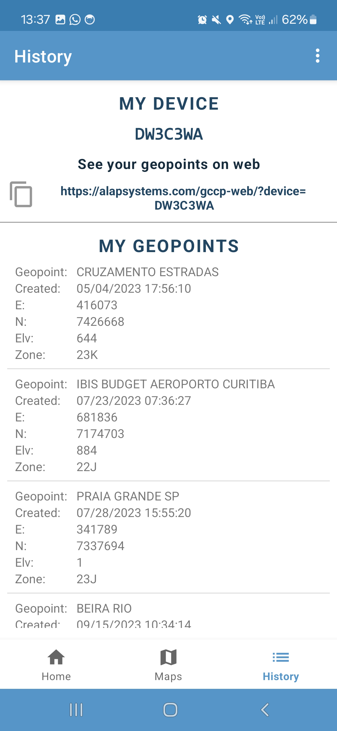

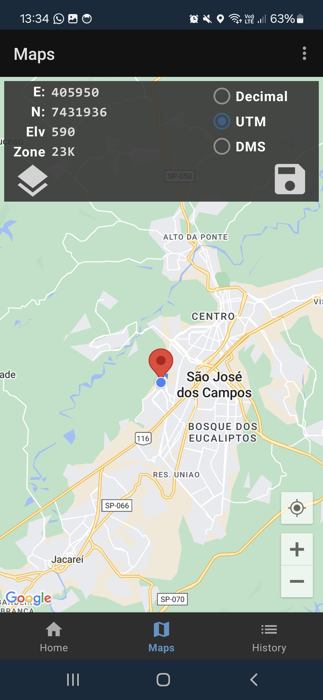
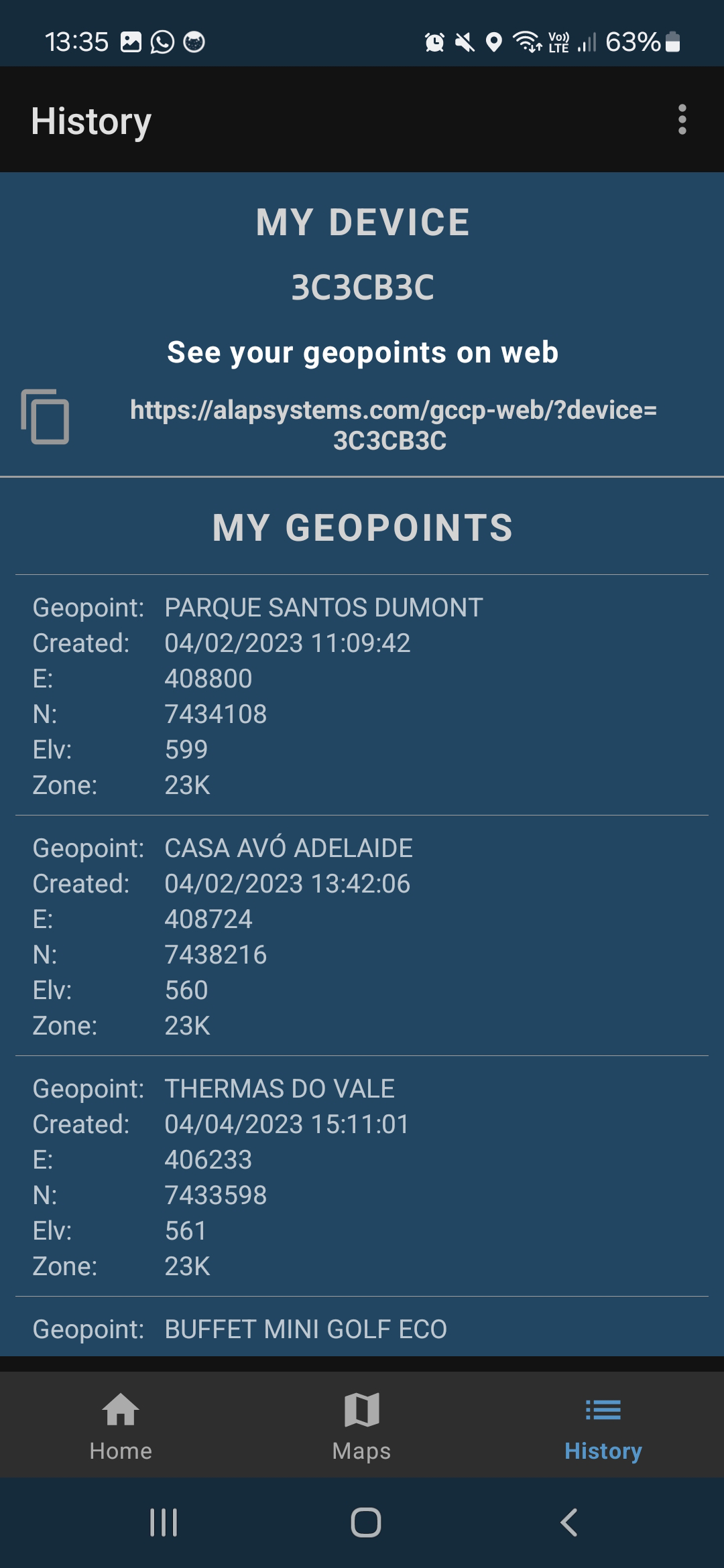
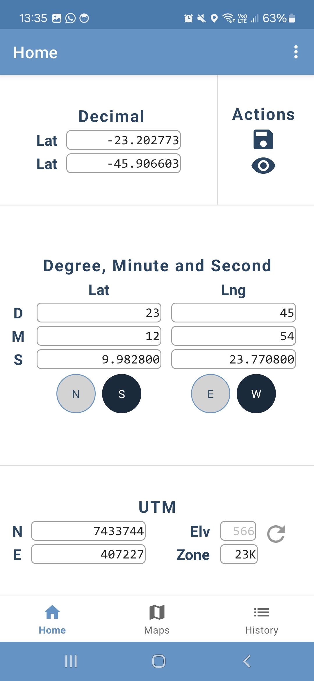

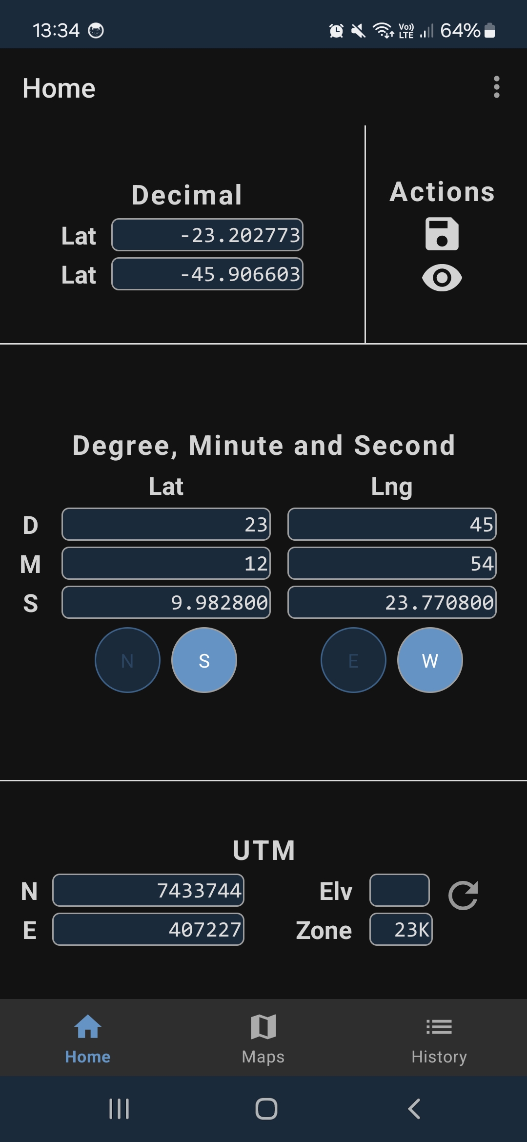

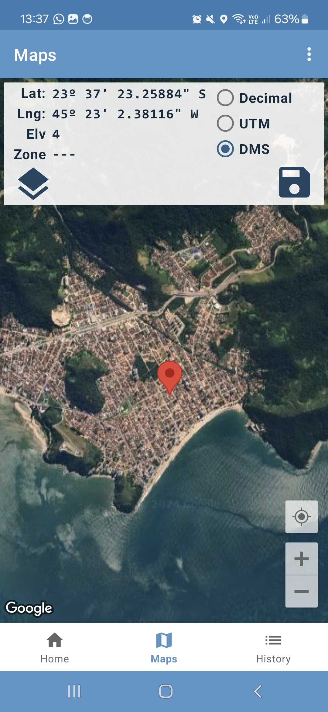
GPS Coordinate Converter · 説明
Geographic coordinates are used to define the position of a point on the Earth's surface. They are expressed in terms of latitude and longitude, which are angular measurements. Latitude measures how far north or south a point is from the Equator, while longitude measures how far east or west a point is from the Prime Meridian.
Converting geographic coordinates involves transforming these measurements into different formats or coordinate systems. The most common coordinate system is the latitude and longitude in degrees, minutes, and seconds (DMS). However, for various applications, such as GPS and mapping software, coordinates are often converted into decimal degrees (DD) or UTM.
Accurate conversion of geographic coordinates is essential for navigation, mapping, geolocation services, and various scientific applications. It ensures that locations are precisely determined and consistent across different systems and platforms. This precision is crucial for everything from everyday navigation apps to sophisticated geographical information systems (GIS) used in urban planning, environmental management, and disaster response.
Understanding and performing these conversions allows for better integration and usage of geographic data, supporting a wide range of technological and scientific endeavors.