Providing maps of the Baltic States, full navigation, address and place search.
advertisement
| Name | BalticMaps |
|---|---|
| Version | 4.2.3 |
| Update | Jan 17, 2025 |
| Size | 40 MB |
| Category | Travel & Local |
| Installs | 100K+ |
| Developer | Jāņa sēta SIA |
| Android OS | Android 5.1+ |
| Google Play ID | eu.balticmaps.android |
BalticMaps · Screenshots


BalticMaps · Description
Original, detailed maps and data of the Baltic States – Latvia, Lithuania, Estonia.
In the free version you can to browse digital raster and vector maps of Latvia, Lithuania and Estonia made by Jana seta and use GPS functionality. In addition, you can:
- see the closest address and WGS/LKS-92 coordinates by placing a marker on the map;
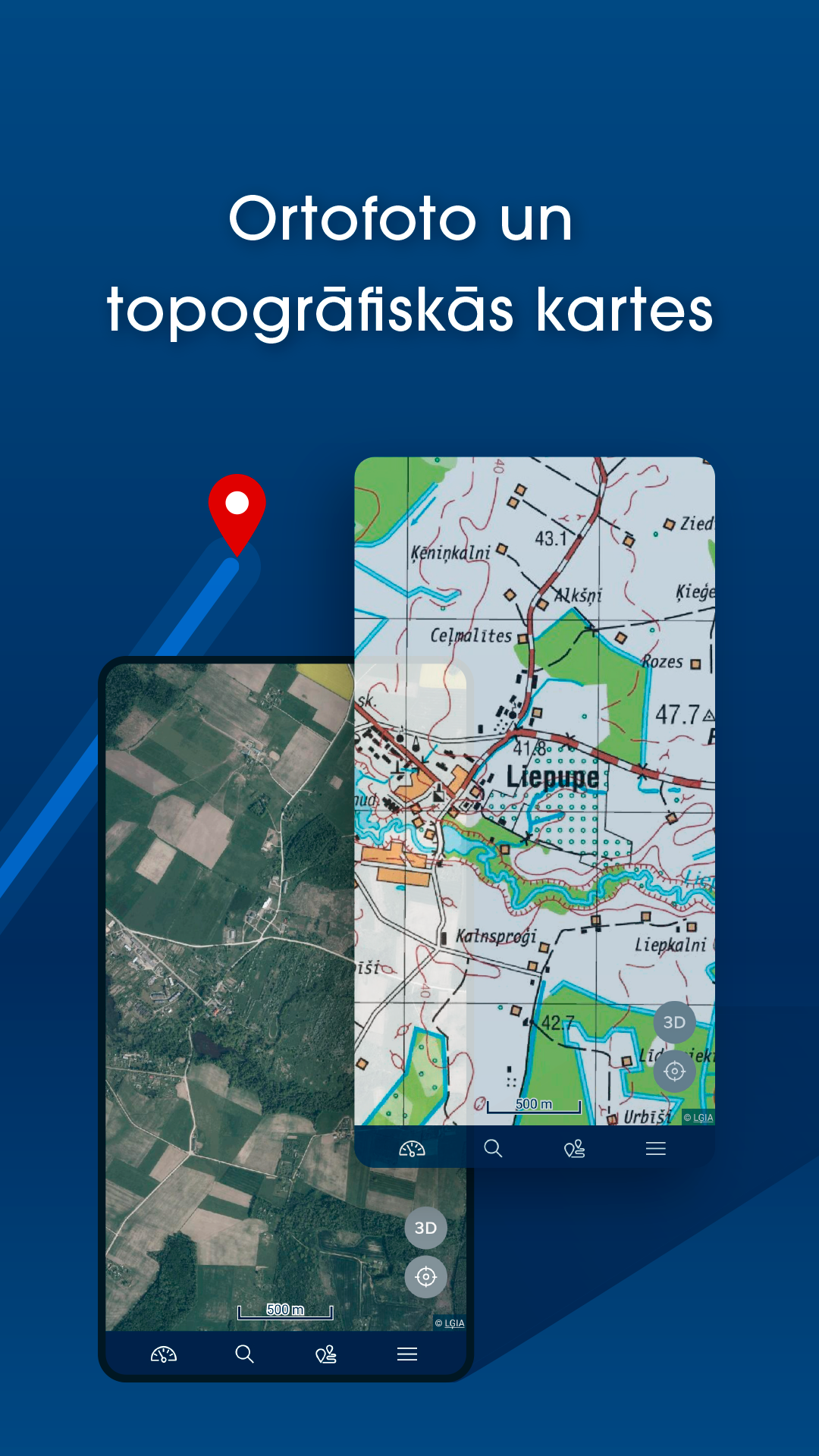
- browse contemporary and historical topographic maps of Latvia;
- browse orthophoto maps of Latvia and Estonia;
- share a location on the map;
- report map data or content error or changes.
By subscribing to the full version, following features will be unlocked:
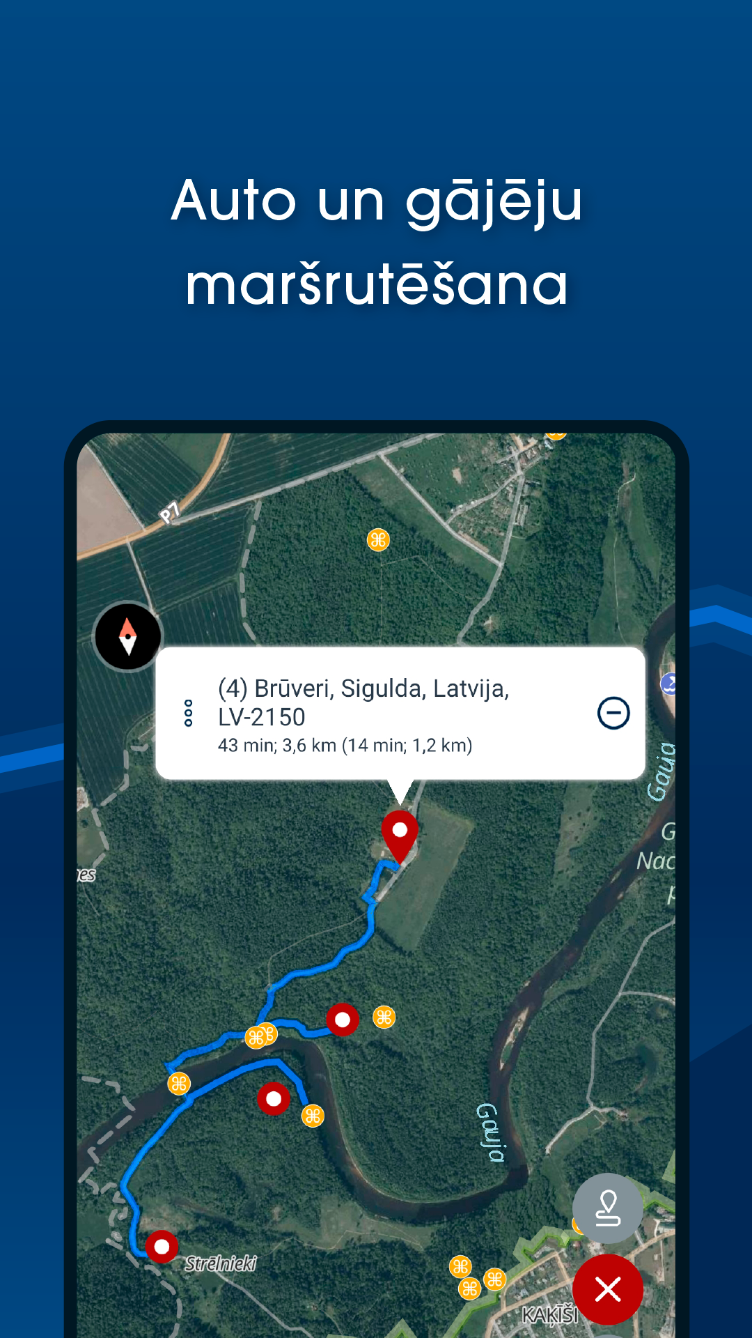
- use full turn-by-turn navigation with voice for cars and pedestrians, including up 50 waypoints;
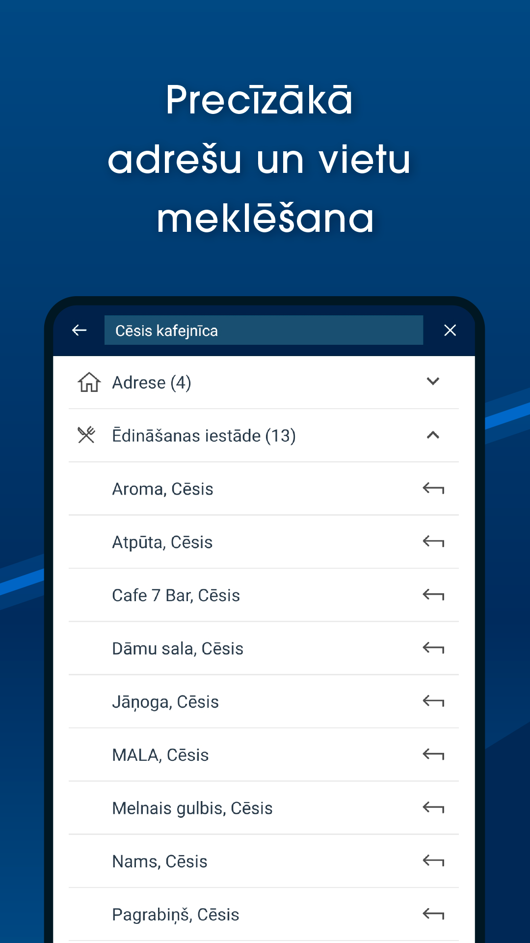
- search for Latvian, Lithuanian and Estonian addresses and places, localities, counties, parishes, rivers, lakes etc.;
- download and use offline vector map;
- see cadastre information and search cadastral parcel and buildings in Latvia;
- live traffic information in Riga and Pieriga (updated every five minutes);
- bookmarking favourite places;
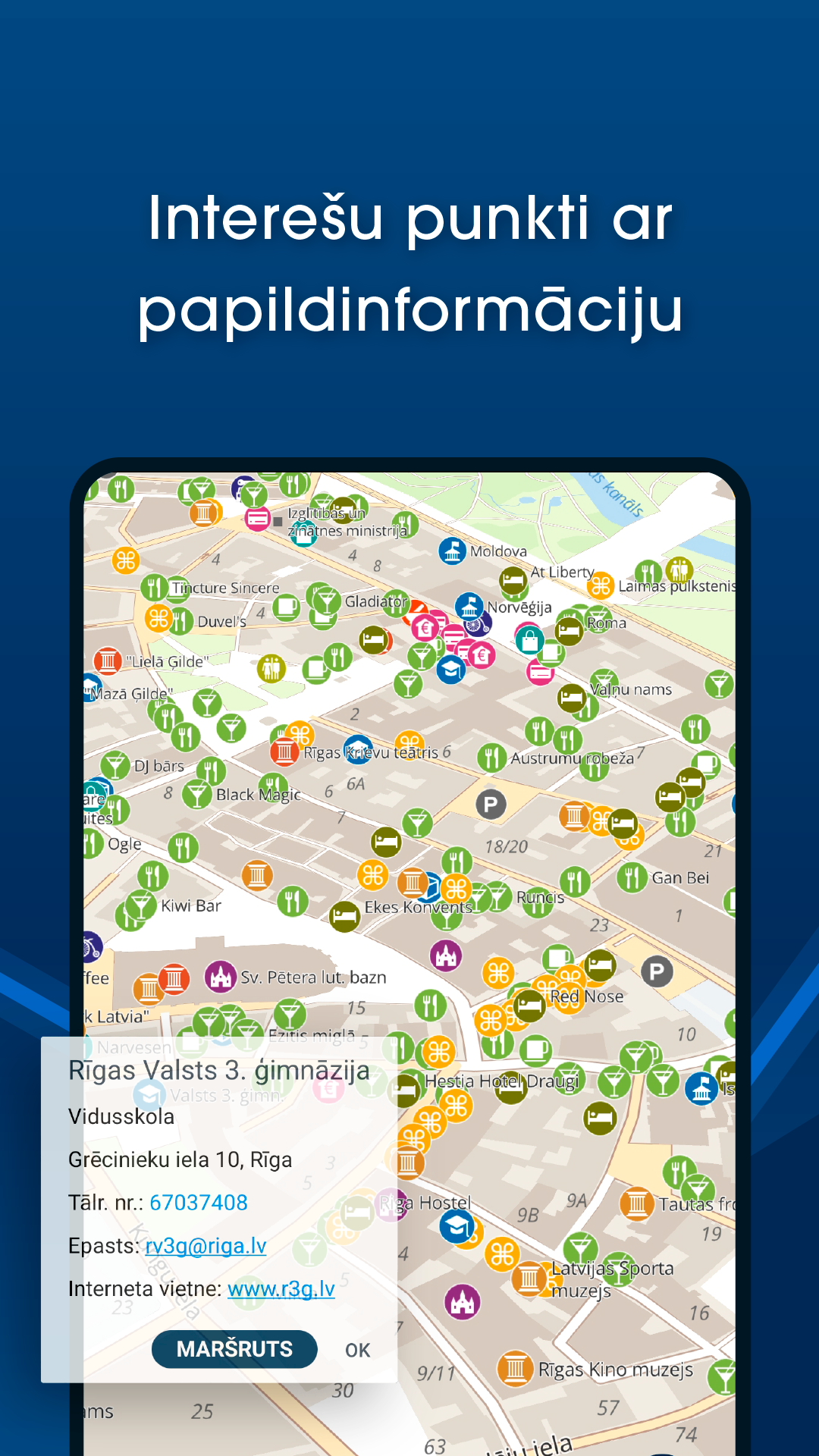
- see points of interest, speed cameras on the map;
- see Baltic-wide long distance hiking trails - the Forest Trail, the Baltic Coastal Hiking Route and the Latgale Lake Trail;
- import GeoJSON, GPX or KML files and view them on the map.
Subscription is based on yearly fee. To subscribe, you need Google Account for payments.
See more information at https://mob.balticmaps.eu/description/en/Description.html
Contact email: android@kartes.lv
In the free version you can to browse digital raster and vector maps of Latvia, Lithuania and Estonia made by Jana seta and use GPS functionality. In addition, you can:
- see the closest address and WGS/LKS-92 coordinates by placing a marker on the map;
- browse contemporary and historical topographic maps of Latvia;
- browse orthophoto maps of Latvia and Estonia;
- share a location on the map;
- report map data or content error or changes.
By subscribing to the full version, following features will be unlocked:
- use full turn-by-turn navigation with voice for cars and pedestrians, including up 50 waypoints;
- search for Latvian, Lithuanian and Estonian addresses and places, localities, counties, parishes, rivers, lakes etc.;
- download and use offline vector map;
- see cadastre information and search cadastral parcel and buildings in Latvia;
- live traffic information in Riga and Pieriga (updated every five minutes);
- bookmarking favourite places;
- see points of interest, speed cameras on the map;
- see Baltic-wide long distance hiking trails - the Forest Trail, the Baltic Coastal Hiking Route and the Latgale Lake Trail;
- import GeoJSON, GPX or KML files and view them on the map.
Subscription is based on yearly fee. To subscribe, you need Google Account for payments.
See more information at https://mob.balticmaps.eu/description/en/Description.html
Contact email: android@kartes.lv