An educational game where you can learn place names and places! Read-aloud and handwritten kanji input available.
advertisement
| 名前 | 地図パズルまぷすた!市町村パズル、世界地図パズル |
|---|---|
| バージョン | 11.0.1 |
| アップデート | 2025年04月15日 |
| サイズ | 168 MB |
| カテゴリー | 教育 |
| インストール | 100千+ |
| 開発元 | akira miyagawa |
| Android OS | Android 5.1+ |
| Google Play ID | com.kudougames.mapstudy |
地図パズルまぷすた!市町村パズル、世界地図パズル · スクリーンショット


地図パズルまぷすた!市町村パズル、世界地図パズル · 説明
playable mode
・Jigsaw puzzle
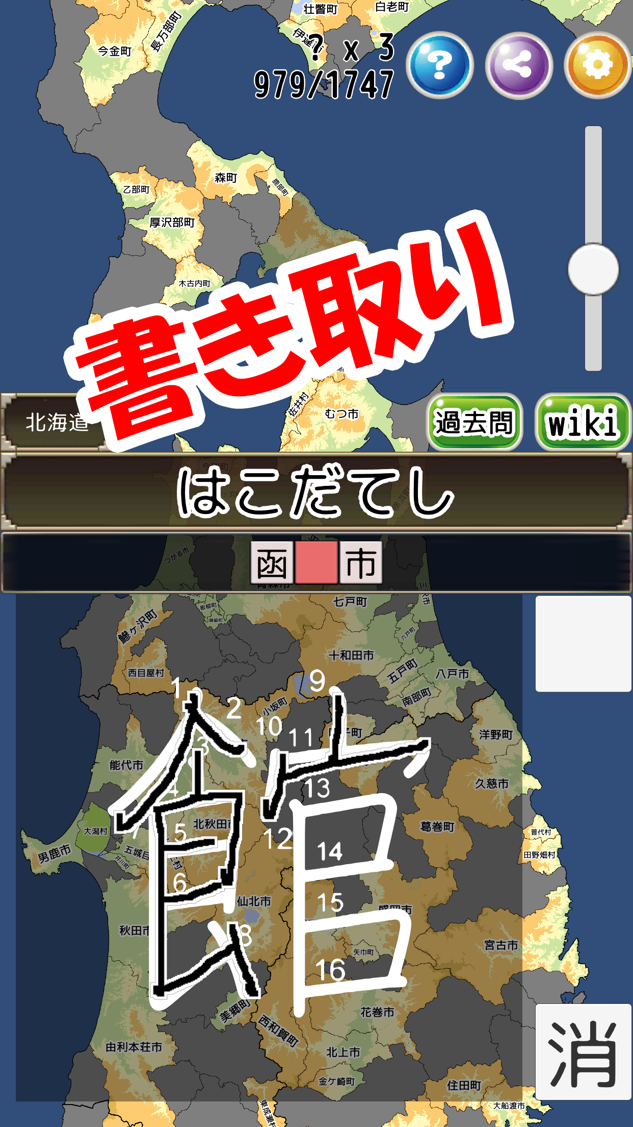
・Kanji reading and writing
・ 6-choice quiz
·fill
Compatible with the following maps
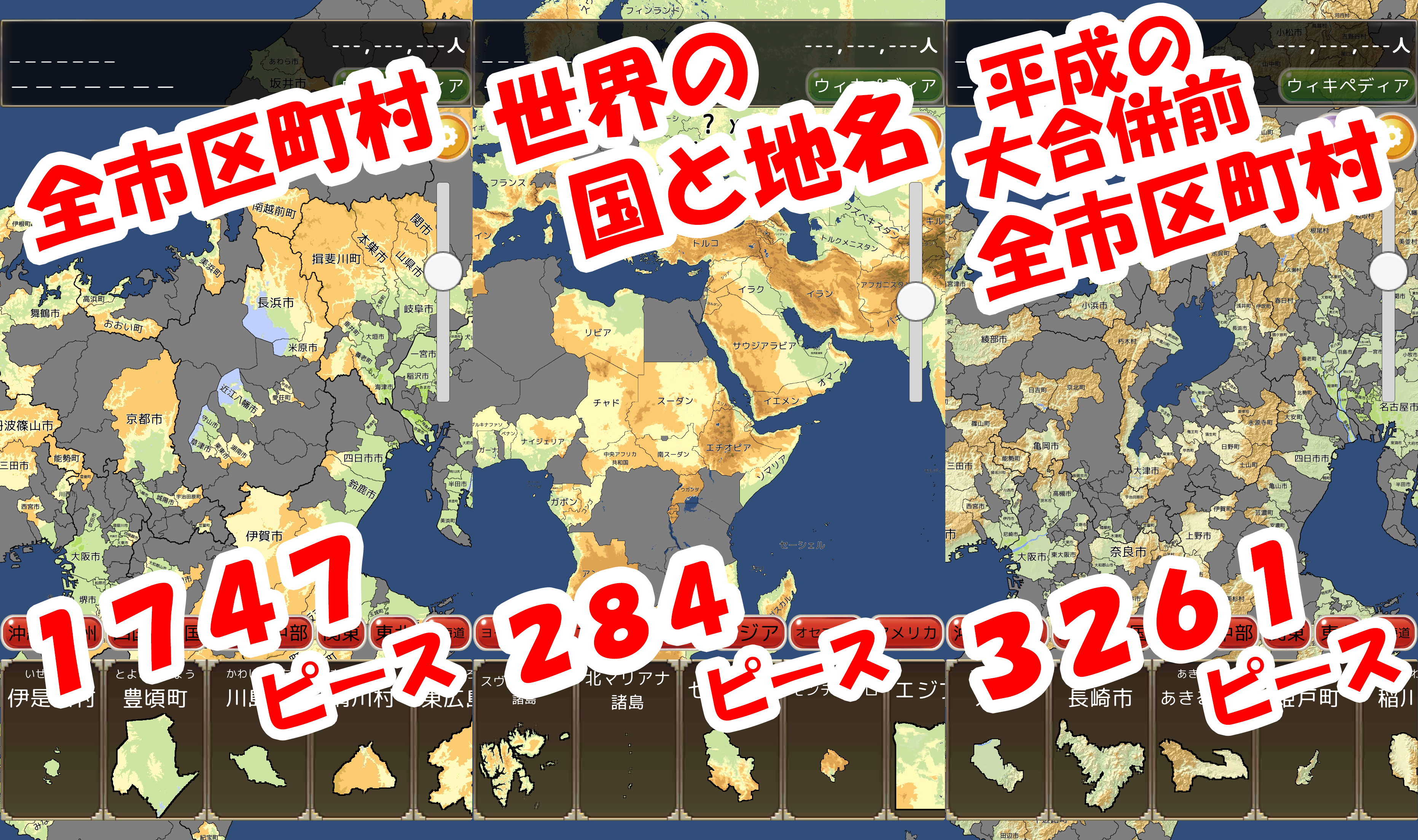
·prefectures
・Prefectural office location
・Municipalities, municipalities (Reiwa, before the Great Heisei Consolidation (1995))
・Countries and place names in the world
・Major Mountain Range Highlands, rivers, mountains, lakes, plains
Various convenience functions
・Read aloud
・Handwritten kanji input, Japanese syllabary input, swipe input, romaji input
・Horizontal screen ↔ vertical screen switching
Difficulty can be increased by changing the settings
・Border display/hide
・Name display/hide
・Switch between elevation map and silhouette (blank map)
Various databases can be browsed
・Graph display of the number of municipalities
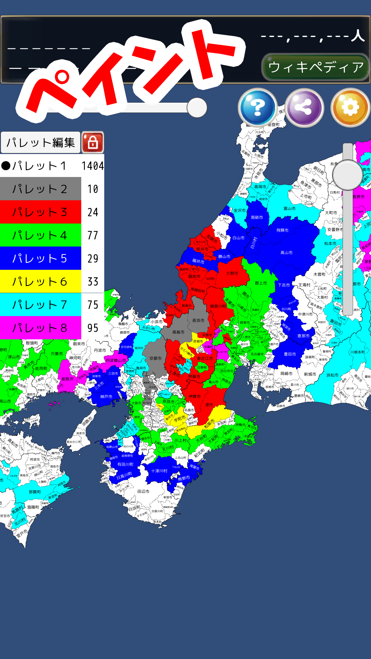
・Map display color-coded by municipality
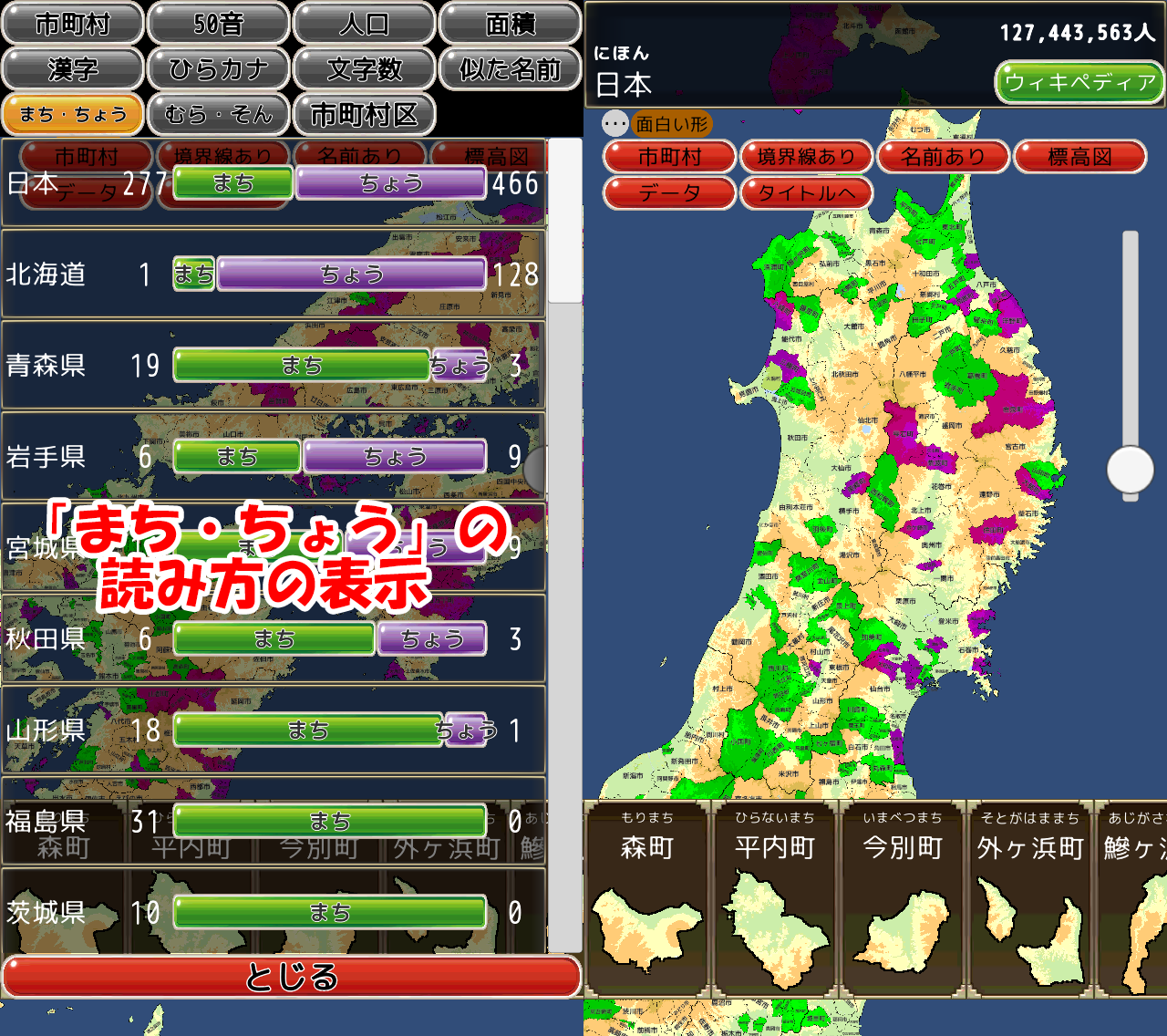
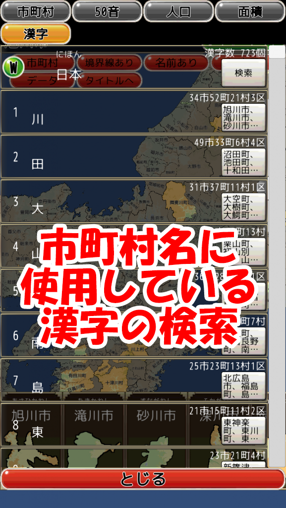
・Displays a list of municipalities that use the specified kanji. For example, which municipality uses the kanji for "love"?
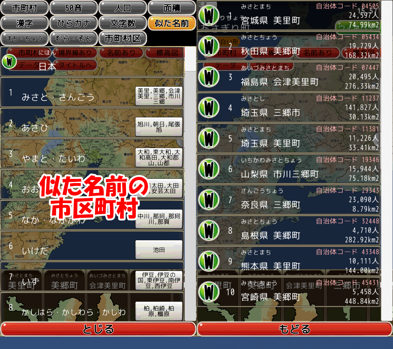
・Display a list of municipalities with similar names such as "Misato-cho, Misato-cho, Misato-cho"
・You can check whether ●●● town or ●●● village is pronounced as "machi-cho" or "son-mura" on the graph and map.
Please check the screenshot for details
・Jigsaw puzzle
・Kanji reading and writing
・ 6-choice quiz
·fill
Compatible with the following maps
·prefectures
・Prefectural office location
・Municipalities, municipalities (Reiwa, before the Great Heisei Consolidation (1995))
・Countries and place names in the world
・Major Mountain Range Highlands, rivers, mountains, lakes, plains
Various convenience functions
・Read aloud
・Handwritten kanji input, Japanese syllabary input, swipe input, romaji input
・Horizontal screen ↔ vertical screen switching
Difficulty can be increased by changing the settings
・Border display/hide
・Name display/hide
・Switch between elevation map and silhouette (blank map)
Various databases can be browsed
・Graph display of the number of municipalities
・Map display color-coded by municipality
・Displays a list of municipalities that use the specified kanji. For example, which municipality uses the kanji for "love"?
・Display a list of municipalities with similar names such as "Misato-cho, Misato-cho, Misato-cho"
・You can check whether ●●● town or ●●● village is pronounced as "machi-cho" or "son-mura" on the graph and map.
Please check the screenshot for details