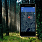
FMap is a specialized mob. app for forestry engineers and craftsmen.
advertisement
| Name | FMap |
|---|---|
| Version | 11.12 |
| Update | Aug 18, 2024 |
| Size | 23 MB |
| Category | Maps & Navigation |
| Installs | 10K+ |
| Developer | Oleksandr Borysenko |
| Android OS | Android 5.1+ |
| Google Play ID | ua.com.xalekter.fmap |
FMap · Description
This development (FMap) is created as specialized software for engineers and foresters of forestry enterprises, it is designed to facilitate and accelerate the work of these professionals.
FMap fully works offline, ie does not require an active connection to the Internet, which is an important condition for working in the forests of Ukraine.
The application provides the following functionality:
1. Display of location on the map of the enterprise (forestry, quarters, allocations)
2. Thematic maps, plantation plans, space images, data of the public cadastral map of Ukraine.
3. Image of the road network
4. Review of taxonomic characteristics of plantations
5. Search for areas by specified parameters (For example: Age = 80, Main species = Scots Pine)
6. Display on the map of assignments entered into the database of the Geoportal "Forests of Ukraine"
7. Removal of coordinates of point objects.
8. Creating categories of point objects and synchronization of these objects on all devices of the enterprise
9. Removal of landfills, area measurement, saving data to a file.
10. Verification of compass survey data, calculation and overlay in the forest.
11. Graphic display of values of azimuths to the place of smoke, objects of fire-fighting device of the enterprise: fire observation towers, water intakes, mineralized strips.
12. The application is also combined with NASA space monitoring data. This means that all spectral anomalies (fires) detected by satellites on the earth's surface will be displayed on a map in the appendix.
Display of elements of the fire-fighting device occurs in a section of all area. This allows additional forces involved from other companies to quickly navigate the forests, as well as find places to replenish tanks with water.


